
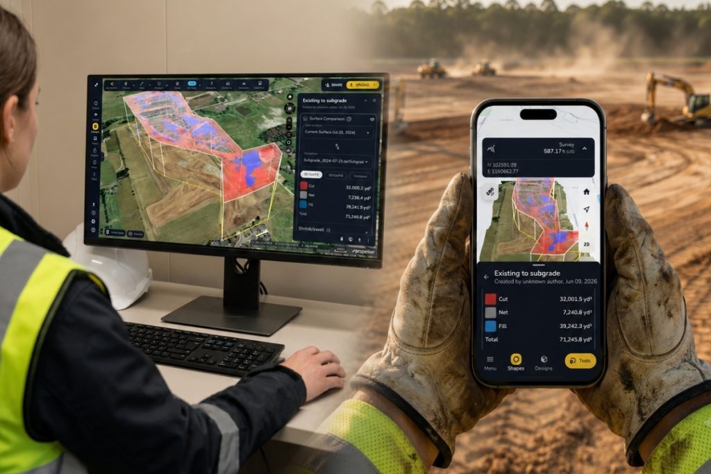
Design-build has a built-in advantage over traditional design-bid-build: one entity is responsible for both design and construction, allowing Owners, engineers, builders and field crews to collaborate from the first day. Propeller is a worksite mapping and data platform that gives teams a shared 3D map connecting design intent with current site conditions throughout the project.
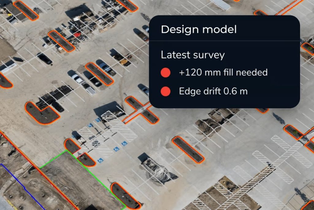
When designs change or site conditions shift, teams need to see the gap between plan and reality before it affects work in the field. Current site data allows them to identify conflicts early, when they can still be resolved in the model, rather than weeks later when crews are already in the ground and rework becomes costly.
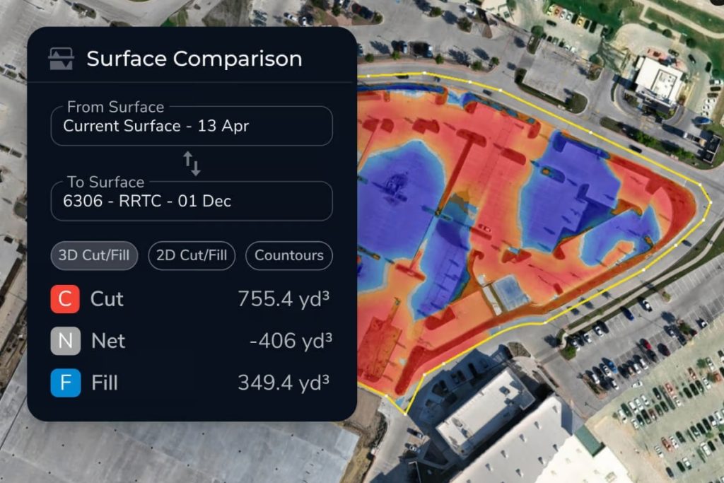
This is why front-loading site capture matters so much in design-build and why the real value comes from repeating it. Capturing current conditions early and then comparing that data against the design surface turns risk into something the team can see and resolve before it becomes expensive. Propeller helps teams turn drone surveys, LiDAR, machine data, design surfaces, measurements and site visuals into clear project intelligence. From one map, teams can quantify cut-fill, verify work against design, measure progress and document changes, building a stronger as-built record as the project moves so the record of what was built stays accurate from day one.
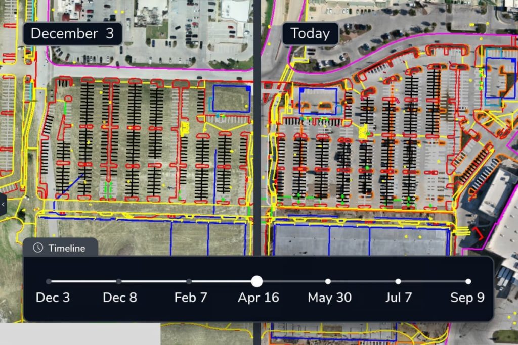
Treating capture as a rhythm changes what QA/QC looks like. Instead of waiting for a single major milestone to validate conditions, teams run a lightweight check on every survey. Fly the site, overlay the latest design files and compare surfaces to see how much material has moved and whether the work matches the model before the next phase begins. Small discrepancies get caught and corrected on a weekly cadence, so they never compound into the kind of conflict that stops a crew. That rhythm starts before ground breaks, with an accurate picture of existing ground for bidding and planning.
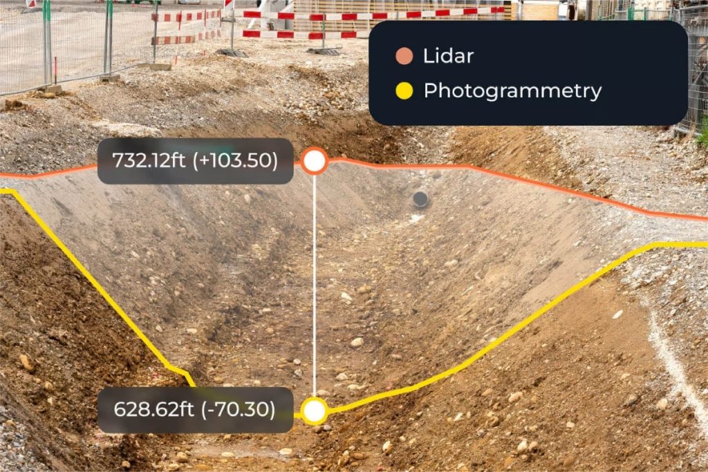
In dense or vegetated terrain, LiDAR captures accurate existing ground through vegetation before clearing, so the design is grounded in real conditions from the start. Haskell, a global design, engineering and construction firm, put this rhythm into practice on a fast-moving worksite running dozens of subcontractors at once. Traditional ground survey methods could not keep pace, so the team flew the full site once or twice a week and overlaid the 3D imagery against their design files. That regular loop is what turned raw capture into a timely decision. On one survey, the overlay revealed a run of underground conduit placed at the wrong location and depth on a path that would have conflicted with an eight-inch pipe. Because the team was comparing site to design every few days, the issue surfaced before the plumbing subcontractor began laying pipe. They corrected the model, coordinated the fix across the affected trades and resolved the conflict with no rework.
Hamzah Shanbari, Haskell’s Technology and Innovation Manager, said, “Propeller helped us recognize issues with the work our subcontractors were doing and correct them before they became expensive.”
That is the takeaway for design-build teams. The earlier and more often you compare the site against the design, the more issues you catch while they are still cheap to fix. A conflict spotted on a Tuesday survey is a quick model adjustment. The same conflict found after the pipe is in the ground is a change order, a schedule hit and a hard conversation about who pays for it.
Across a full project, that difference adds up to outcomes teams can measure. They protect their margins by keeping earthwork on budget and billing against documented, timestamped quantities. They protect their schedule by resolving conflicts in the model before crews are affected. And they hand over a clean, accurate as-built record that was built continuously through the job rather than reconstructed at closeout. For design-build delivery, where a single team owns both the design and the outcome, an ongoing shared map is what keeps everyone accountable to the same plan.
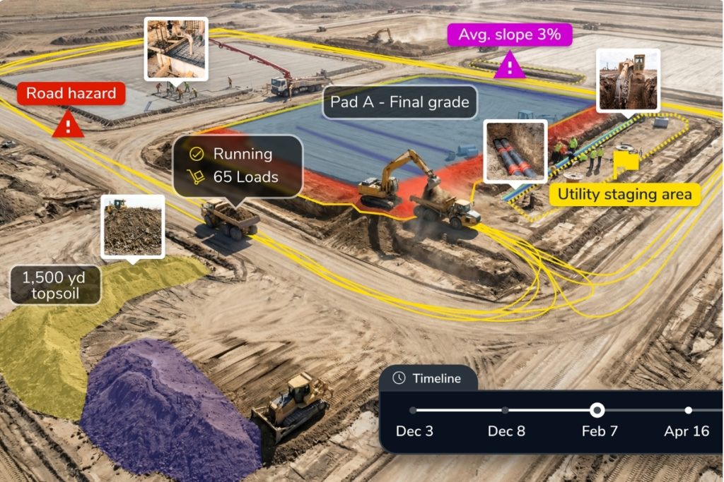
The advantage of design-build is collaboration from the start. Propeller helps teams keep that collaboration alive through every phase, so complex projects stay coordinated, avoidable rework goes down and the whole team keeps moving with confidence from one shared map.

Jimmy Anthony, Copywriter, Propeller
Jimmy Anthony is a senior copywriter at Propeller, where he turns earthwork tech, drone data, and geospatial software into words that make sense to the people actually using it on site. Ten-plus years of making complicated things readable.
Propeller helps design-build teams align design intent with worksite reality. Because one team owns design and construction, they can collaborate from day one. Propeller extends that head start across the whole build, uniting survey, GIS, design and machine data in one shared 3D map. Teams catch conflicts early, verify quantities, document changes and keep complex projects on schedule and on budget.